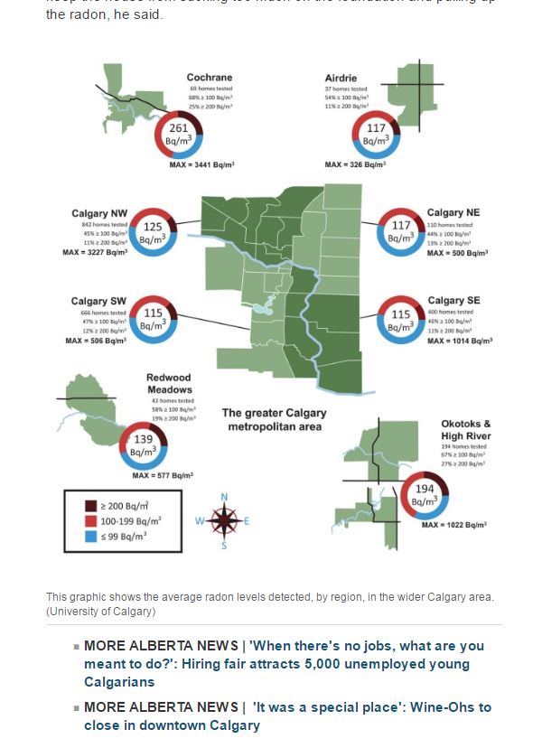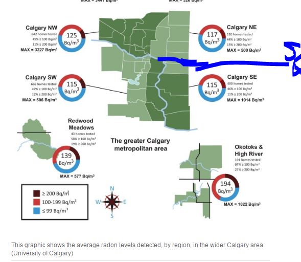
In a recent CBC Article, the University of Calgary (Medicine School) published a study but failed to understand Calgary’s quadrant system.
The University inaccurately published a Calgary Map putting the northern region of the Southeast quadrant into the Northeast quadrant. Communities such as Albert Park (directly adjacent to Inglewood), Radisson Heights and Forest Lawn were all commingled into the Northeast. Fueling the stereotypes of where the so called “poor” areas of Calgary are.
The University of Calgary did not respond to our inquiry.
UPDATE 5/5/2017 3:39 PM: The CBC removed the inaccurate map from the news article. The University of Calgary still has not responded to our inquiry.
Original entry on the CBC article before removal: