


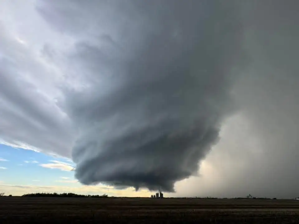
Residents of the Peace River region are surveying the damage Monday night after a powerful tornado touched down in northwestern Alberta, leaving a path of destruction that stretched across dozens of kilometres.
The twister developed as part of a larger supercell thunderstorm that swept through the area during the evening hours. Environment Canada meteorologist Janelle Gergely explained the atmospheric conditions that sparked the severe weather event.
"We had a big frontal system move through and in behind that main front we had an area of showers," Gergely said. "On the southern area of showers, a supercell developed and that produced a tornado."
Eyewitness Account From Ground Zero
Riley Connors, a Girouxville resident living about four and a half hours northwest of Edmonton, was driving home from work when the storm intensified. What began as darkening skies quickly escalated into something he had never experienced before.
"I've never seen anything like that before," Connors said, noting his East Coast upbringing didn't prepare him for Alberta's severe weather. "It just started picking up real bad, like getting super windy. My hat was blowing off and stuff."
When Connors arrived at his property, the scope of the damage became clear. His metal roof had been compromised, his truck window was shattered, and surrounding vehicles and buildings bore extensive damage from the violent winds.
"It was just a mess. Bunch of damage on vehicles, bunch of roofs messed up. It was devastating."
Tracking and Documenting Severe Weather
Environment Canada collaborates with The Northern Tornadoes Project at Western University to verify and document tornado activity across Canada. The project's research team uses data collected from severe weather events to build tornado risk models that inform insurance companies, building code standards, and emergency preparedness protocols.
Dr. Dave Sills, director of the Northern Tornadoes Project, emphasized the importance of comprehensive data collection for long-term weather analysis.
"We use it to build tornado risk models and that informs the insurance industry, building codes, that kind of thing. We use it to verify Environment Canada's tornado warning program. We do tornado warning report cards to see how well the tornado warning system is doing," Sills explained.
The research team has compiled tornado data dating back to 1980, allowing scientists to analyze long-term weather pattern changes and investigate potential links to climate change and other factors influencing tornado formation.
One Storm, Multiple Reports
Environment Canada received the initial tornado report near Girouxville around 8 p.m. Monday. Approximately 90 minutes later, another sighting was reported near High Prairie, roughly 80 kilometres to the southeast. Rather than separate weather events, meteorologists confirmed both reports originated from the same supercell.
"It was actually the same supercell, so it was very consistent as it tracked," Gergely said.
While at least one tornado has been confirmed, Environment Canada and the Northern Tornadoes Project indicate additional tornadoes may have occurred during the event. The investigation and documentation of Monday's severe weather activity continues as cleanup efforts get underway across the affected Peace River communities.
This article is based on reporting from Global Calgary.